Like many smaller urban areas of New Zealand, preserving and enhancing walkability in the historic town centre of Greymouth is a challenging prospect when car accessibility is a parallel and often conflicting key objective. The Town Development Strategy 2010 recognises that providing good pedestrian linkages improves access for residents who do not drive, reduces transport system demand and encourages tourists to stay and explore Greymouth longer, amongst many other acknowledged economic, social and health benefits of walking.
ViaStrada's John Lieswyn led a "walk shop" with key stakeholders to identify walkability issues and possible solutions, followed by a public meeting. The meeting included a slide show presentation, questions and answers, and general discussion.
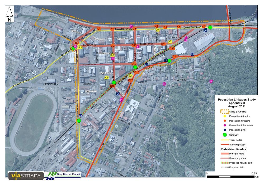
The study used these inputs, previous submissions, data collection and mapping to develop a pedestrian network. The network is supported by a comprehensive action plan for council consideration in the annual plan process.
The study process focused on the establishment and strengthening of working relationships between council departments and stakeholders, with the aims of leveraging a wide range of funding and assisting with implementation.
Some of the key recommendations include:
- the restoration of a historic link across the railway tracks,
- enhanced or additional pedestrian crossings of the state highway and a major truck route along the waterfront, and
- consideration of a 30 km/h pedestrian zone in the town centre.