Transport planning and policy
We undertake a wide range of transport planning and policy services, including
- School and workplace travel plans
- Reviews of and advice regarding transport legislation/regulations
- Speed management reviews/strategies
- Development/update of walking/cycling strategies and network plans
- Transport/parking reviews of new development proposals
- Area-wide sustainable transport plans
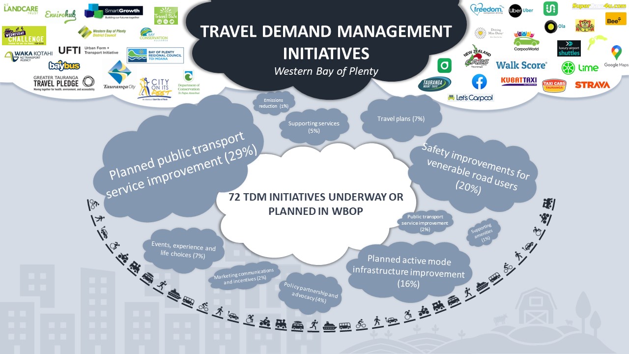 ViaStrada supported Vitruvius by preparing an online StoryMap of Travel Demand Management case studies, assessing travel demand by each mode, existing and proposed networks, and the opportunity for mode shift if supported by various scenarios of behaviour change investments.
 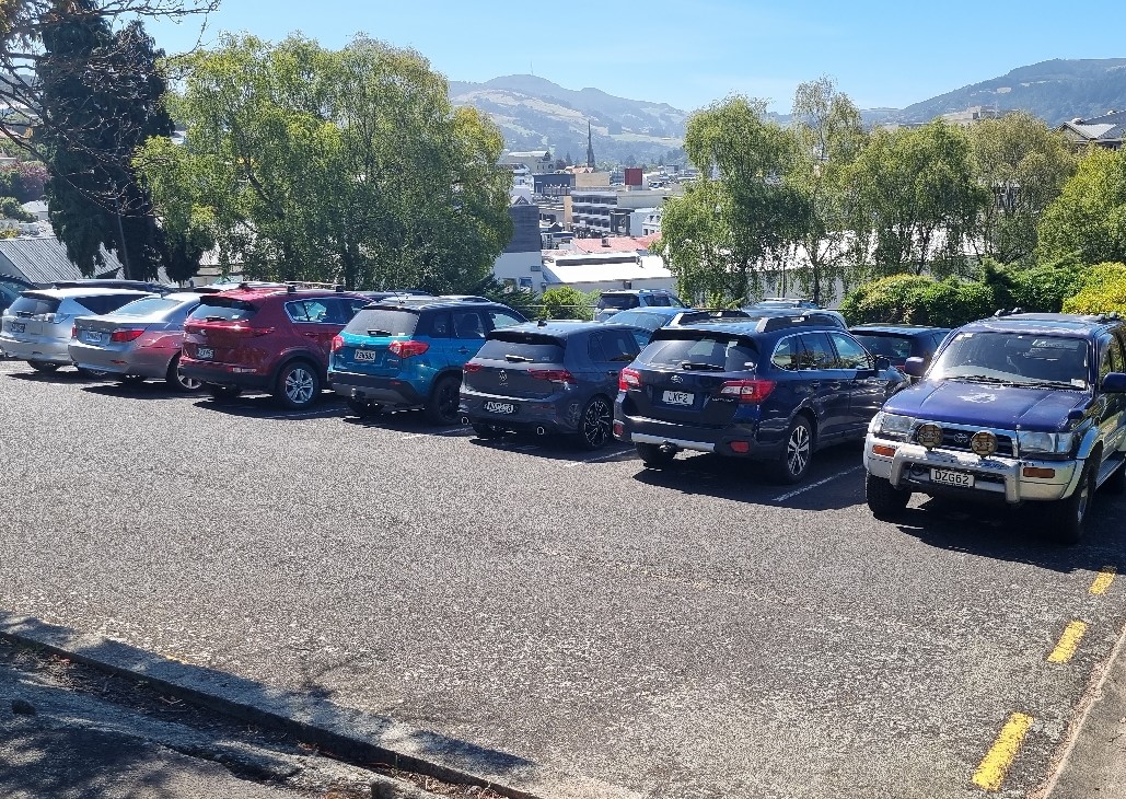 Dunedin City Council staff asked ViaStrada to set up and complete a survey of parking demand in the city centre. The aim was to provide a comprehensive picture of parking usage over time (during the day and week) to inform future parking strategies.
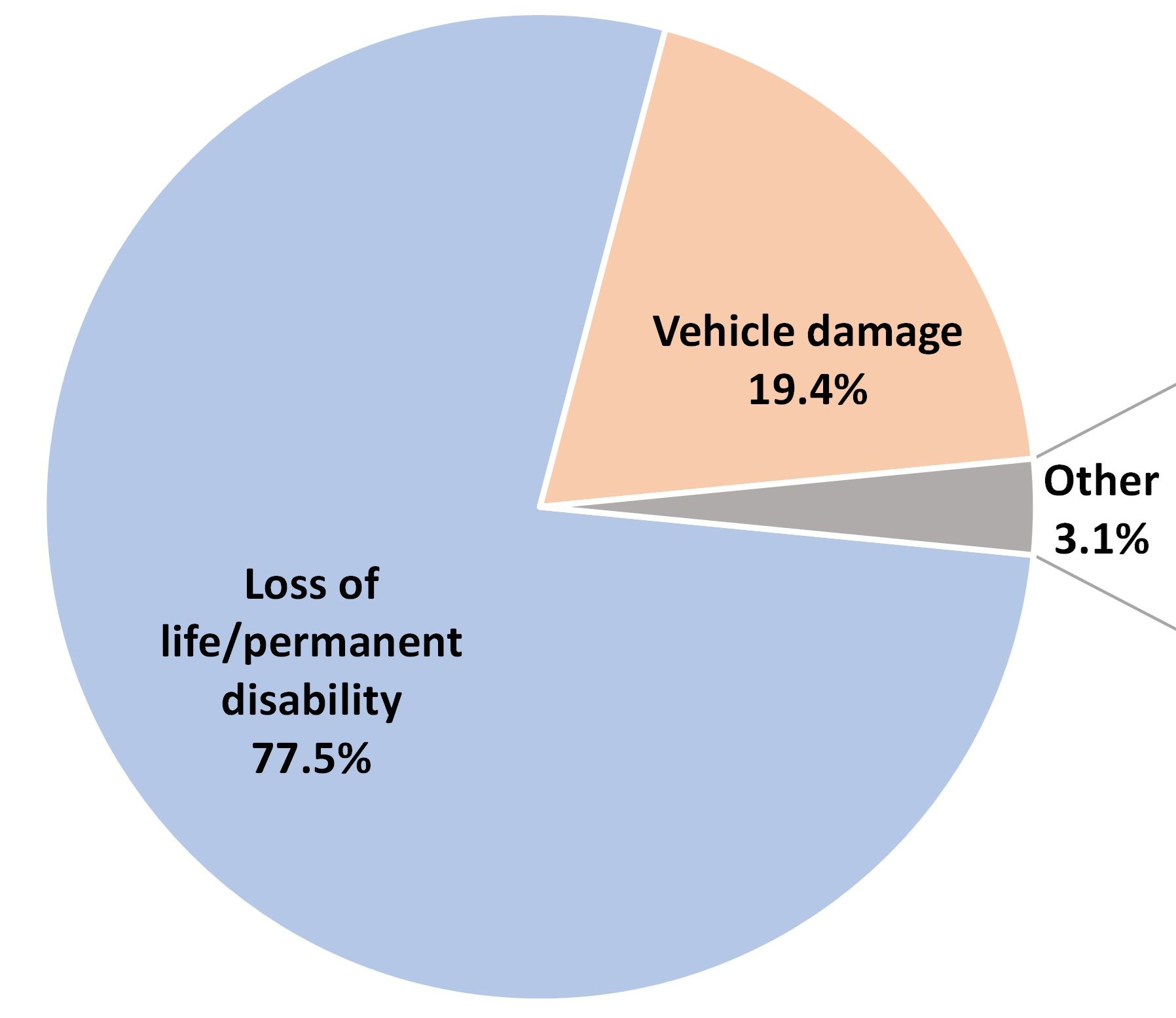 ViaStrada delivered a working paper summarising the methodology and calculations to derive estimates of the Total (Social) Costs, Average Costs, Marginal Costs and Marginal Externality Costs of road transport-related accidents in New Zealand. This was a component in a wider study on domestic transport costs and charges.
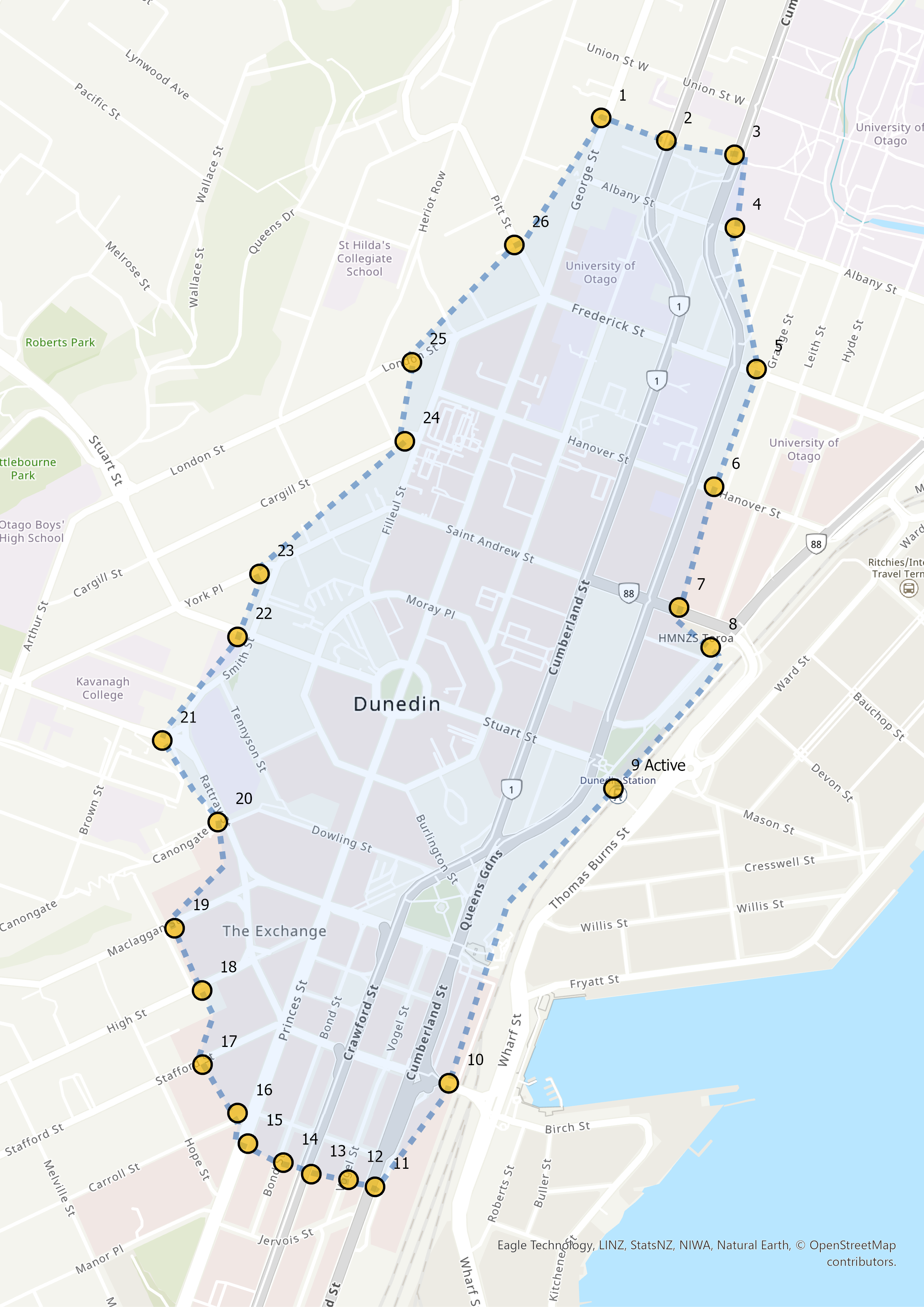 Dunedin City Council commissioned ViaStrada to develop and run the third annual iteration report of the ‘cordon count’, providing a snapshot of how people arrive at and travel through central Dunedin. "Cordon” refers to an imaginary boundary around the central city where surveyors were located at the most important entry/exit locations along this boundary. Surveyors were positioned at 26 sites around the central city to count the people and vehicles passing by over two days during the morning peak from 7:30-9:30 am.
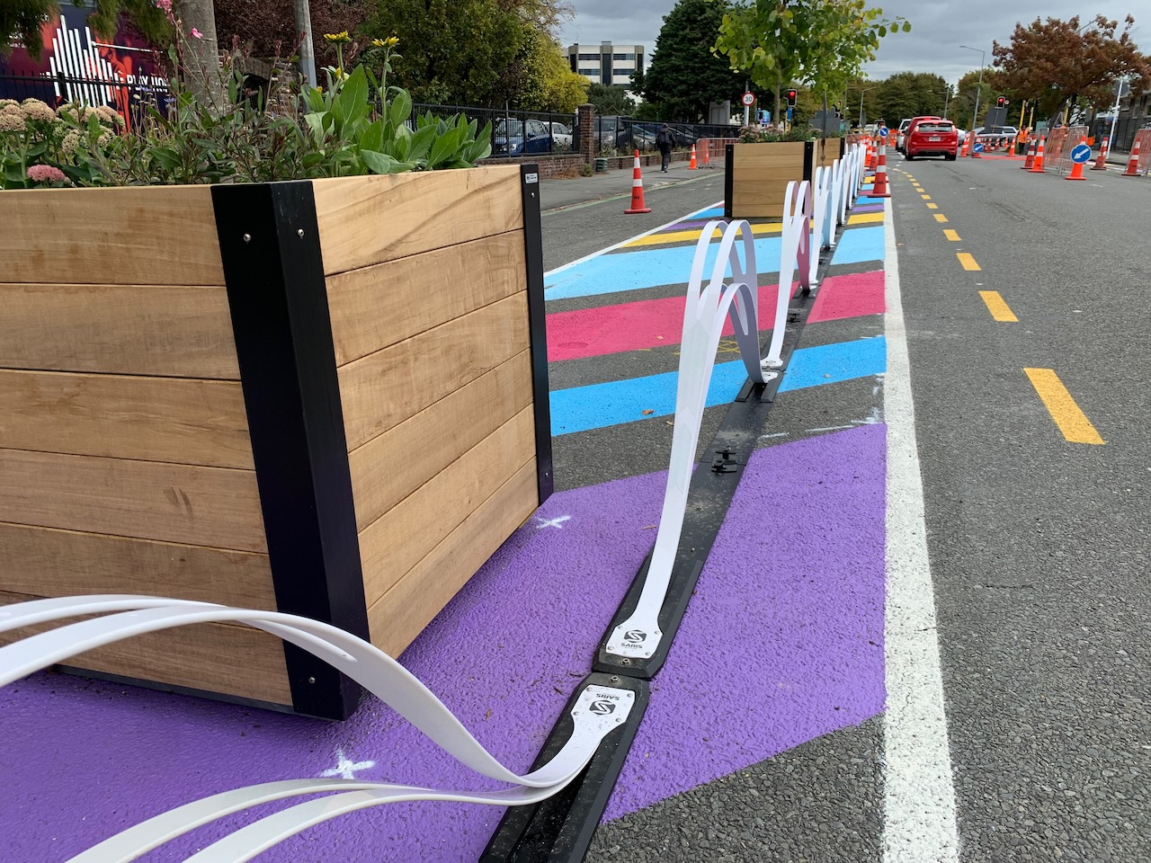 Waka Kotahi commissioned ViaStrada to undertake research on quick-build (interim) cycleway infrastructure. This research note provides information about the best infrastructure options for installing quick-build (interim) separated cycleways to increase safety and encourage mode shift in a visually, physically and aesthetically consistent manner on a national scale.
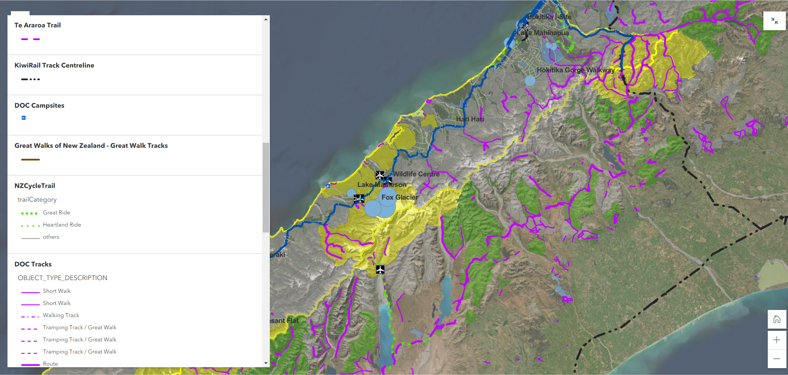 The Department of Conservation commissioned a report and webmap to summarise the transportation context for the Waiau Weheka Westland long term visitor plan.
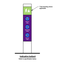 Whakatāne District Council asked ViaStrada to provide a wayfinding signage plan for Whakatāne District's walking and cycling network. Its focus: how can we help people (and visitors) navigate their community?
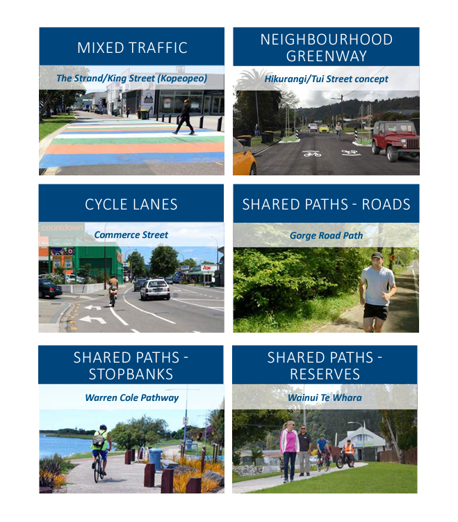 ViaStrada worked closely with council staff and community leaders to produce a fun to read strategy and an interactive online map of the walking and cycling network.
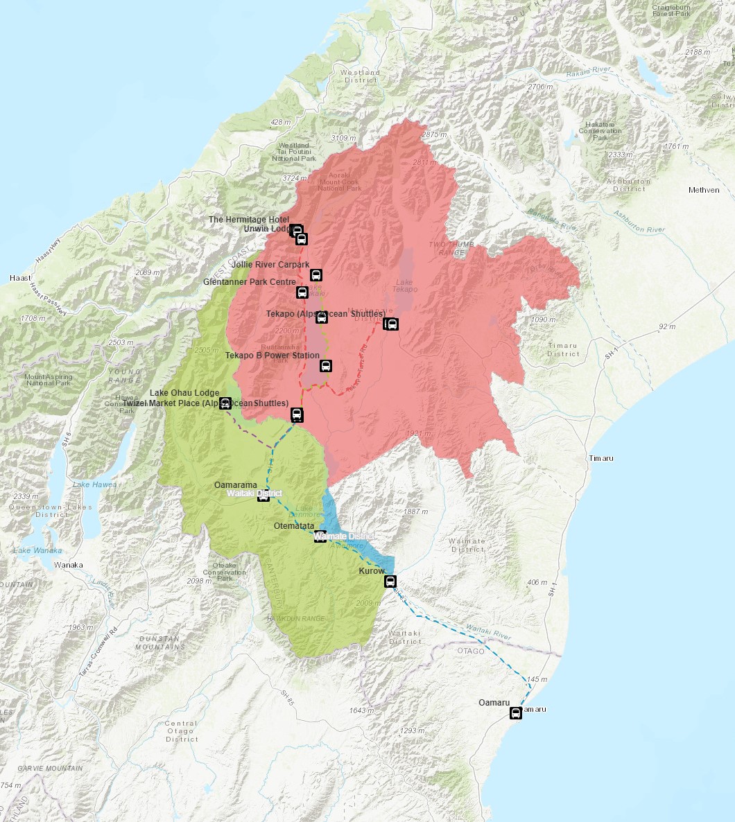 The Department of Conservation (DOC) commissioned ViaStrada to create a web map application about transport-related content in Mackenzie District, Upper Waitiaki District and a part of Waimate District.
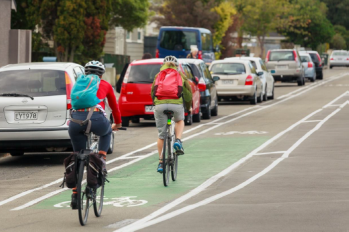 Palmerston North City Council plans to invest $2.9M in urban cycleways over the 19/20 and 20/21 financial years. ViaStrada has developed a public facing, graphically rich masterplan to help guide that investment – including a range of cycleways and supporting education and encouragement activity recommendations. The work included the development of an interactive online map. Concurrent with the masterplan, ViaStrada developed a single stage business case to NZ Transport Agency requirements, delivered in 2020.