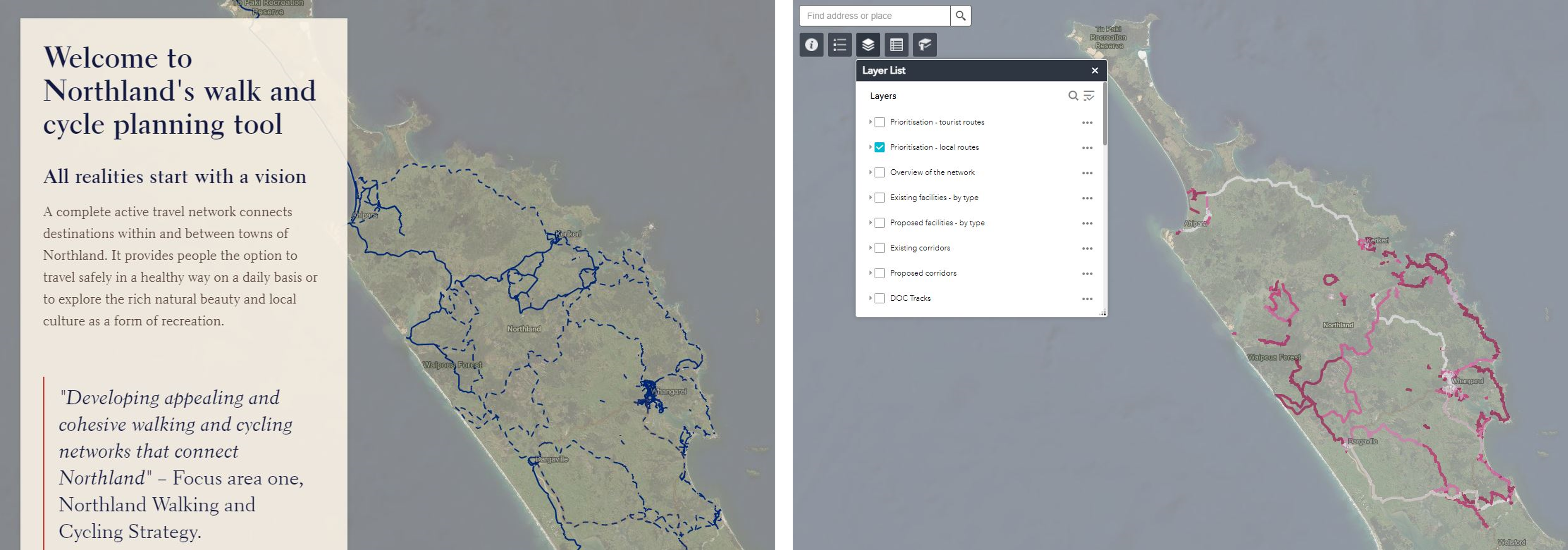
Northland's walk and cycle planning tool
Developing appealing and cohesive walking and cycling networks that connect Northland is focus area one in Northland’s Walking and cycling strategy. In order to establish these networks ViaStrada created a planning tool for Far North District Council. Planners, engineers and maintenance staff within council and partner organisations can use this tool for network analysis, prioritisation and engagement.
We have collated, mapped and linked information from various road and path project proposals including rural road safety improvements, shared paths, footpaths, town centre streetscape and placemaking proposals. To this we added data collated on field visits (i.e. availability of bicycle parking, pedestrian crossings, wayfinding signs) and open source data (i.e. population growth and relevant destinations).
For this project ViaStrada used ArcGIS software to combine all data and develop two types of interactive maps:
- A StoryMap, which is open to the public
https://storymaps.arcgis.com/stories/d4916541f5224b91914008058ec078ee
The story map guides readers through Northlands walk and cycle network vision and the important factors for implementation. It starts with a journey in time whereby the story visualises Norhtland’s network in 3, 6, 10 and > 10 years’ time. It introduces an approach to prioritise the construction of different facilities. Then the story continues to explain what is important for the development of routes for leisure and attraction of tourist. Lastly, routes for local daily active travel are visualised per township. These maps are supported by population growth data and information about local community contacts.
- A web application, which can be used for council staff
The web application provides council staff the opportunity to adjust data and extract data in a user-friendly way.