

This is just a selection of some of the many projects that ViaStrada has been involved in over the years - click on the filter icon to refine the search by topic areas.
Projects
Filter
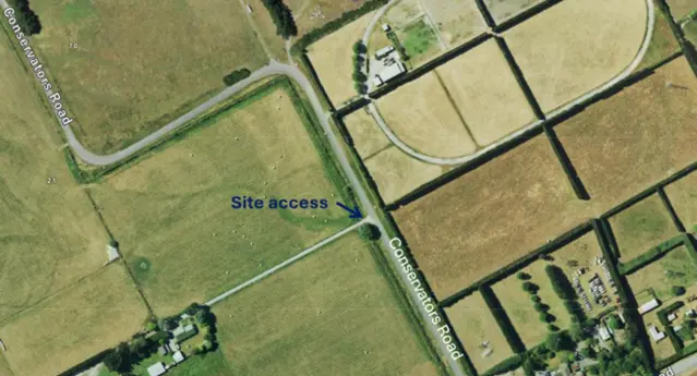
Conservators / Guys / Savills Road DDRSA
ViaStrada was commissioned by e2 Environmental Ltd to undertake a detailed design stage Safe System Audit of intersection improvements at Conservators
…
Read More
Minimum walking data requirements to progress pedestrian safety
How do we measure progress toward zero pedestrian deaths? ViaStrada research for Austroads identified the essential pedestrian data needed to support
…
Read More
DOC Accessibility Audits
New Zealand’s conservation estate includes many campgrounds and walking trails that are at least partially accessible to people of all ages and
…
Read More
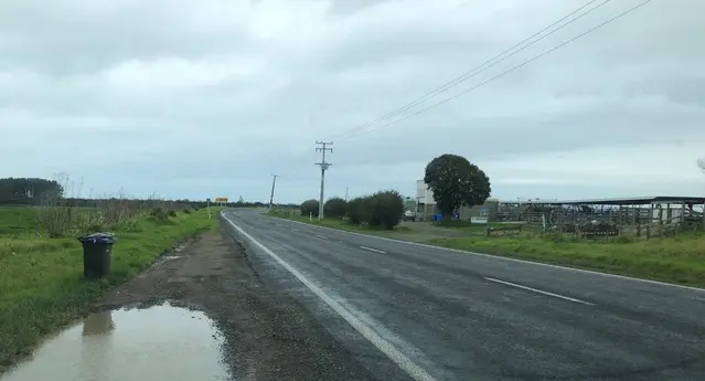
SH6/ Victoria Flats, road intersection upgrade
ViaStrada completed a road safety audit for proposed intersection upgrades at Victoria Flats Road on the Gibbston Highway (SH 6), helping ensure a new
…
Read More
Waipuna Estate – Traffic Impact Assessment (TIA)
Narrow rural roads and busy event venues don't always mix, but careful traffic assessment can show when they do. ViaStrada examined how a proposed
…
Read More
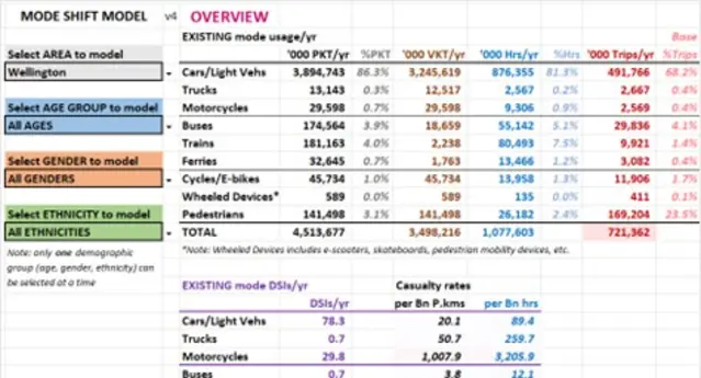
NZTA Mode-shift vs Safety Model update
TGNZ and NZMUGS commissioned ViaStrada to investigate and further update the existing NZTA model determining the estimated safety impacts of mode
…
Read More
Driver competency and knowledge over time
ViaStrada and Mackie Research were commissioned by AA Research Foundation to investigate how driver knowledge changes over time and how it could be
…
Read More
Metro Christchurch customer insights meta-analysis
Listening to our communities: Shaping the future of public transport. Environment Canterbury recently partnered with ViaStrada to dive deep into what
…
Read More
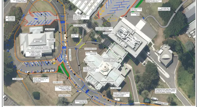
Pukenamu Queens Park ITA and Parking Management Plan
Pukenamu Queens Park is the cultural heart of Whanganui — home to libraries, a gallery, a museum, and memorial spaces that tell the stories of our
…
Read More
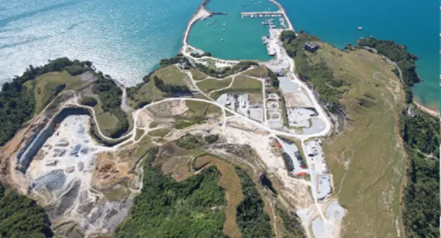
Port Tarakohe road access feasibility study
How do you future proof a port access road? ViaStrada evaluated two alignment options for Port Tarakohe and identified a safer, more robust solution
…
Read More
VKT impacts of road space reallocation
ViaStrada was commissioned by NZTA to investigate the measured network vehicle-kilometres-travelled (VKT) impacts of permanent road space reallocation
…
Read More
Buchanans Road caravan park
How do we ensure safe access for a proposed caravan park?
Read More
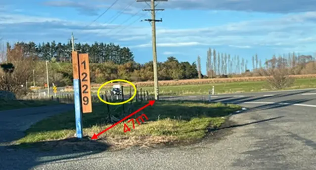
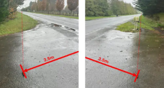
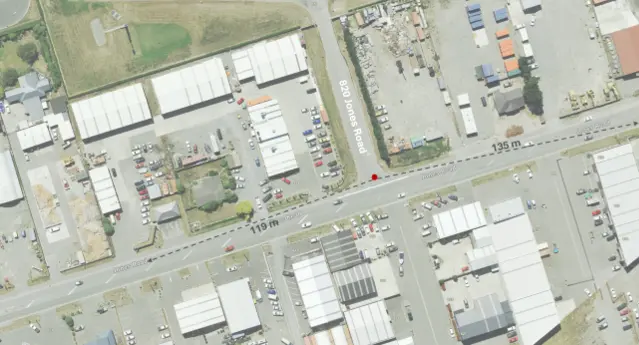
Driveway access on Christchurch to Akaroa highway
ViaStrada was engaged to help reconfirm driveway access to SH75 for a proposed subdivision along the Christchurch–Akaroa route. Through a detailed
…
Read More
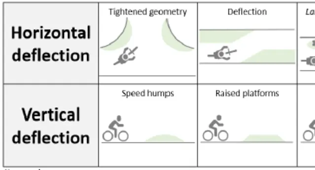
Path Speed Management Research
New Zealand Transport Agency Waka Kotahi commissioned ViaStrada to study how well horizontal and vertical design features manage path user speed,
…
Read More
Shands Road Sawmill Integrated Transport Assessment
ViaStrada completed a comprehensive Integrated Transport Assessment (ITA) to support the development of a proposed new biofuel pellet plant
…
Read More
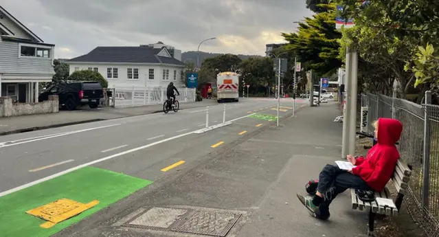
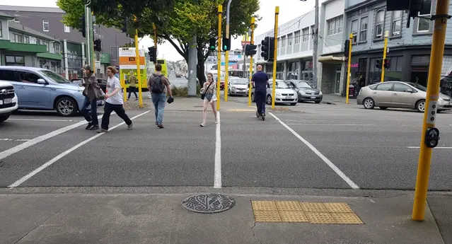
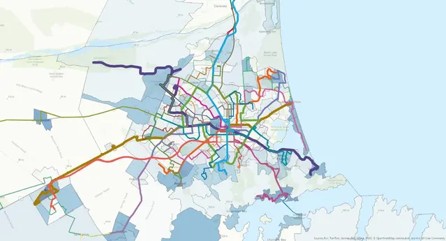
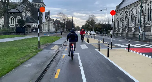
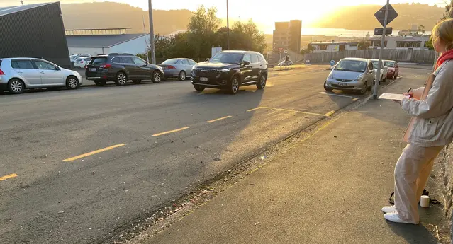
Wellington bicycle and scooter cordon count
How can monitoring the number, gender, and road position of people entering Wellington’s central city by bike or scooter help shape the future of
…
Read More
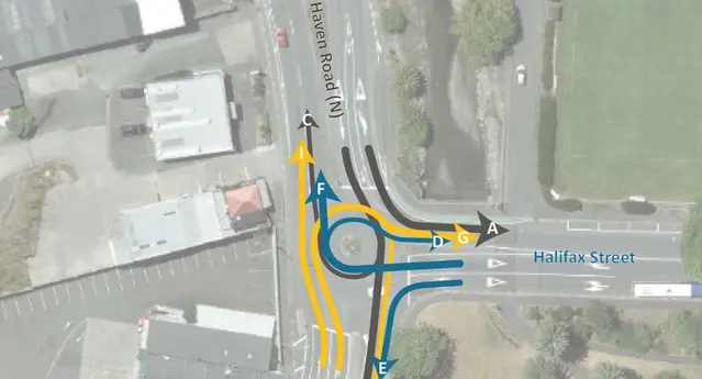
Haven/Halifax business case and design review
The existing intersection of Haven Road and Halifax Street is currently controlled with a small diameter multi-lane roundabout. The adjacent land use
…
Read More
Thornton Road Realignment audits, Whakatāne
ViaStrada conducted the detailed design safety and post-construction audits of the Thornton Road re-alignment project. This was a short section of
…
Read More
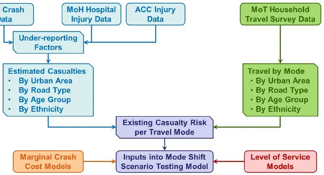
Mode shift impacts on safety
ViaStrada was commissioned by NZTA to undertake research on the overall safety impacts of mode shift away from private motorised vehicles to whole
…
Read More
Dunedin Monitoring Framework Stocktake - Stage 1
The client has many different sources of transport information and called upon ViaStrada to help collate these, map them against the Land Transport
…
Read More
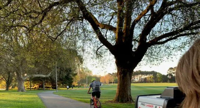
Micromobility speed, gender and device type surveys
How fast do e-bike and e-scooter riders go? Is e-mobility helping to address the gender imbalance? Following on from surveys of cycleway user speed,
…
Read More