

This is just a selection of some of the many projects that ViaStrada has been involved in over the years - click on the filter icon to refine the search by topic areas.
Projects
Filter
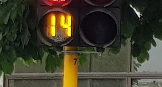
Dunedin SH1 Barnes Dance Trials
The NZ Transport Agency commissioned ViaStrada to formally trial two "Barnes Dance" shared pedestrian/cycle crossings along SH1 in Dunedin, including
…
Read More
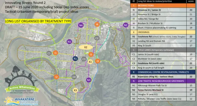
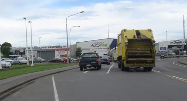
Whakatāne Innovating Streets
ViaStrada prepared a successful funding application for our council client including issues, solutions, costs, engagement and monitoring plans.
Read More
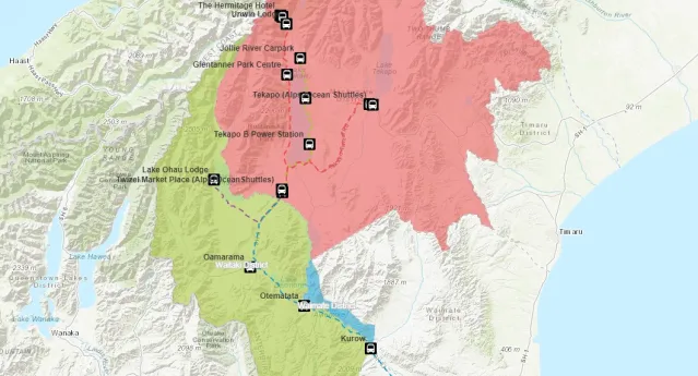
Mackenzie District Visitor Transport Mapping
The Department of Conservation (DOC) commissioned ViaStrada to create a web map application about transport-related content in Mackenzie District,
…
Read More
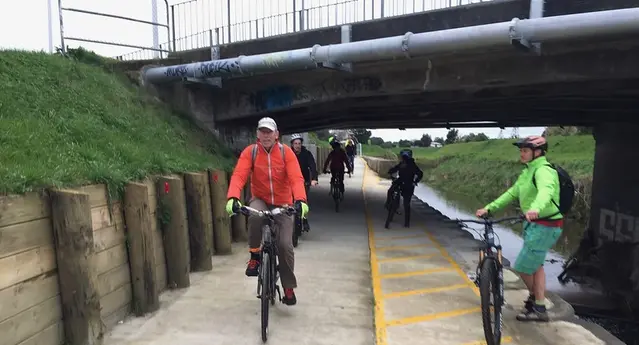
Palmerston North urban cycling network masterplan
Palmerston North City Council plans to invest $2.9M in urban cycleways over the 19/20 and 20/21 financial years. ViaStrada has developed a public
…
Read More
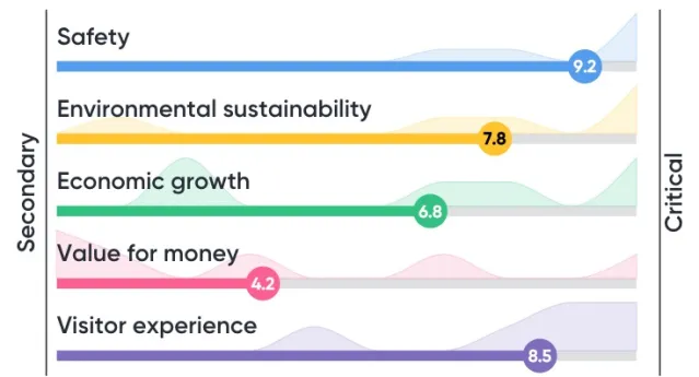
Ruapehu - Tongariro National Park Transport Gap Analysis
The Department of Conservation (DOC) commissioned ViaStrada to review a range of planning documents and provide advice to inform Visitor Management
…
Read More
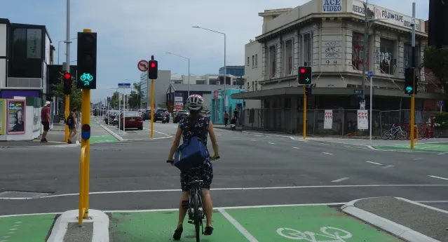
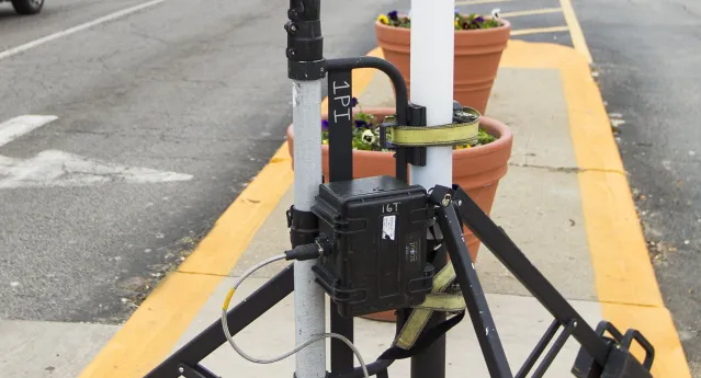
Directional cycle signals trial
A formal Traffic Control Device trial of directional cycle signals has been approved for four locations; two in Christchurch and two in Auckland.
…
Read More
NSW Fatigue-related rural road crashes & solutions
Transport for New South Wales commissioned ViaStrada to create a benefit-cost analysis tool that assesses measures that prevent fatigue-related road
…
Read More

Passing lane and overtaking opportunities
ViaStrada has been engaged to assess the recommendations of the previous studies and identify any additional locations where it may be possible to
…
Read More
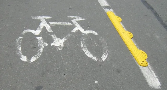
Cycle lane separators
ViaStrada was commissioned by VicRoads (the state roading authority of Victoria, Australia) to undertake research on physical bicycle lane separators.
…
Read More
Williams Street pedestrian count
ViaStrada was commissioned by Waimakariri District Council (WDC) to investigate and quantify the pedestrian activity at five locations on Williams
…
Read More
Christchurch automatic cycle counting programme
Andrew, Jeanette and Megan have developed an automatic cycle counting programme for Christchurch City Council (CCC). The project identifies
…
Read More
Banks Peninsula data collection
The Christchurch City Council now has a record of all the markings and signs on the Peninsula. All traffic control devices requiring a Council
…
Read More

Rail Trail traffic counting
ViaStrada undertook and analysed counts of cycle traffic on the two existing sections of the Little River Rail Trail - between Prebbleton (on the
…
Read More
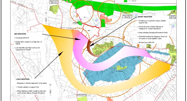
Woodend western bypass assessment
The Waimakariri District Council (WDC) commissioned ViaStrada to undertake a high level assessment of the possible western bypass options for Woodend
…
Read More
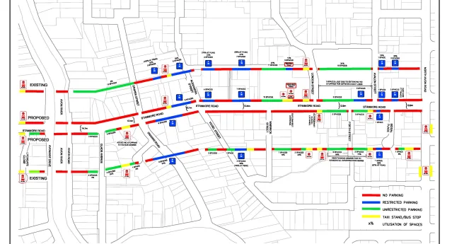
Stanmore Road parking location plan
The client wanted to see how the existing parking supply was on the street. This gave maximum information on the impact of different cycle lane
…
Read More
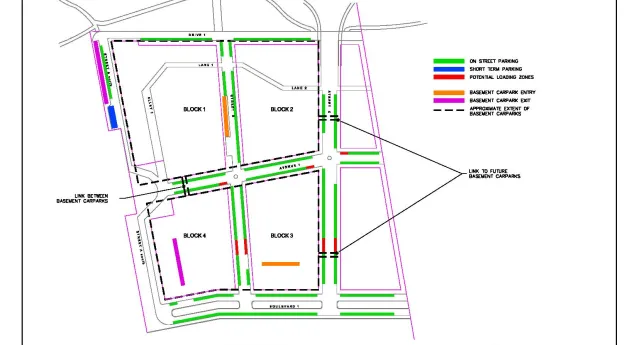
FiveMile parking provision plan, Queenstown
The client wanted to show that they had made provision for various on street parking demands in FiveMile. This included short and long term parking
…
Read More
NZTA continuous cycle counting research
ViaStrada researched continuous cycle counting technology for the New Zealand Transport Agency. The research report is now available. By "continuous"
…
Read More

Cycle counting in NZ
This project consisted of two components:1) an internet-based survey of road controlling authorities (RCAs) and regional councils about their
…
Read More
Auckland regional cycle network assessment
MWH New Zealand Ltd (Christchurch) and ViaStrada evaluated five different potential cycle network models. ARTA’s British expert peer reviewer thought
…
Read More
Lowther St (Christchurch) queue and delay study
Christchurch City Council commissioned ViaStrada to undertake a queue and delay study on the Lowther Street approach to Main South Road (SH73A), where
…
Read More