Multi-modal or “complete streets” design requires specialist expertise to incorporate good provision for walking and cycling. As authors of most of the national walking and cycling guidance, ViaStrada can lead a design project or serve as the Client’s advisor.
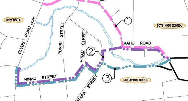
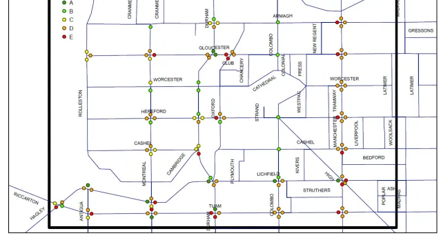
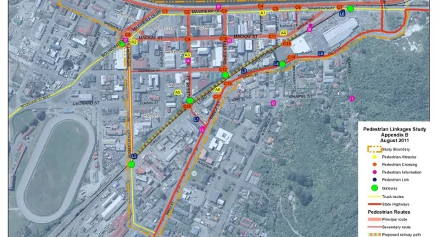
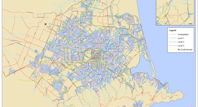
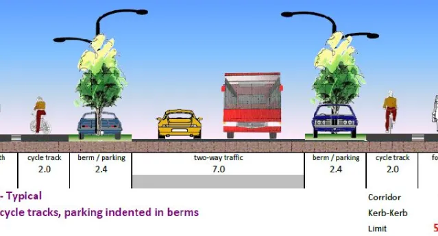
Walking & cycling facilities
Relevant Projects
Tennyson Street off-road cycle paths
ViaStrada has reviewed a controversial cycle facility for Christchurch City Council and found people either love it or hate it!
Key Contact: Axel Downard-WilkeLake Road cycle lane options
Cycle lanes had been approved by North Shore City Council (NSCC) for installation on Lake Road between Esmonde Road and Hauraki Road, a distance of about 600 m. ViaStrada developed and reviewed alternative options for accommodating cyclists on this 23 m road corridor carrying four lanes of traffic.
Key Contact: Axel Downard-WilkeDunedin cycle lanes
ViaStrada has been commissioned to design provisions for cyclists in some of the more challenging locations of Dunedin's arterial network. Dunedin City Council picked us as their preferred consultant because of our nationally recognised expertise in this area.
Key Contact: Axel Downard-WilkeHornby rail trail, Christchurch
The Little River Rail Trail is planned to extend from Hornby (Christchurch) to Little River on Banks Peninsula. ViaStrada undertook this investigation into the feasibility of providing a rail trail from Hornby to Prebbleton as part of the Christchurch – Little River Rail Trail.
Key Contact: Warren LloydAudit methodology for Canterbury regional cycle network
Environment Canterbury (ECan) is developing a regional cycle network plan. ViaStrada staff developed an audit methodology, enabling alternative network elements to be compared with one another. The resulting methodology combines site visits with a clever RAMM assessment.
Key Contact: Warren LloydAuckland regional cycle network assessment
MWH New Zealand Ltd (Christchurch) and ViaStrada evaluated five different potential cycle network models. ARTA’s British expert peer reviewer thought that our GIS-based methodology, using Auckland demographic data and existing transport models, was pretty clever.
End result – a clear idea of how to develop the regional cycling network (and a happy client!).
Key Contact: Axel Downard-Wilke