Transport planning and policy
We undertake a wide range of transport planning and policy services, including
- School and workplace travel plans
- Reviews of and advice regarding transport legislation/regulations
- Speed management reviews/strategies
- Development/update of walking/cycling strategies and network plans
- Transport/parking reviews of new development proposals
- Area-wide sustainable transport plans
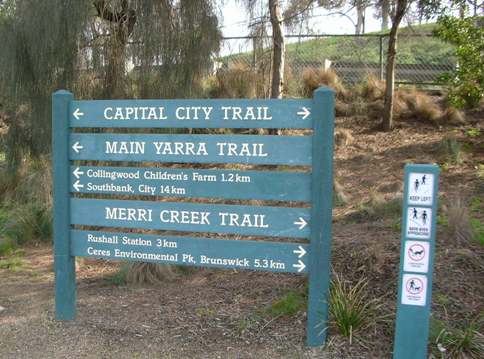 Bike path users in Melbourne can often find it difficult to find their way around on the many off-road paths around the city. Hence, a review of the adequacy of signposting was required.
 For Northlands Mall, we were commissioned to explore access options and designs through to obtaining Resource Consent from the City Council.
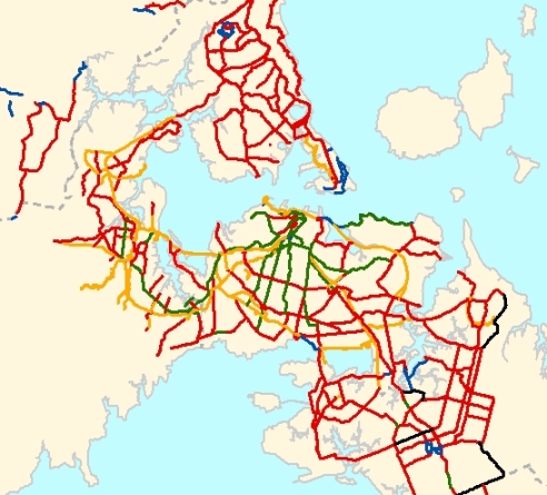 MWH New Zealand Ltd (Christchurch) and ViaStrada evaluated five different potential cycle network models. ARTA’s British expert peer reviewer thought that our GIS-based methodology, using Auckland demographic data and existing transport models, was pretty clever.