Project filter
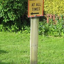
Banks Peninsula data collection
Lorraine and Jon have been out and about on Banks Peninsula recording the road markings, one way bridge priorities and other traffic control devices.
When Banks Peninsula District Council was amalgamated with Christchurch City Council, it was difficult to reconcile some of the traffic resolutions with the markings and traffic controls on the road, and other records were difficult to find.
Key Contact: Warren Lloyd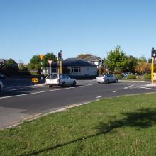
Clarence Street and Dilworth Street traffic signals
As part of the Westfield expansion of Riccarton Mall, the intersection of Clarence Street and Dilworth Street was converted from a give way intersection to traffic signals. ViaStrada was commissioned by Westfield to design the new layout, undertake the community consultation and prepare final design plans for construction. Finalising the layout required working closely with the Christchurch City Council, the traffic signals contractor and the client.
Key Contact: Axel Downard-Wilke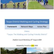
Taupo District Walking and Cycling Strategy
Walking and cycling are popular forms of recreation within the Taupo District due to the many events, temperate climate, and mostly gentle topography. Events encourage locals to take up cycling or walking as a sport or recreational activity and are important generators of business and tourism. However, most transportation is done by car. A strategy which sets the Council's strategic direction for recreation, tourism and transport is considered a key planning document to assist in achieving a "Walking and Cycling Friendly District".
Key Contact: Warren Lloyd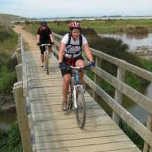
Rail Trail traffic counting
Megan Fowler and Andrew Macbeth undertook and analysed counts of cycle traffic on the two existing sections of the Christchurch to Little River Rail Trail - between Prebbleton (on the south-western edge of Christchurch) and Lincoln and between Motukarara and Little River (on Banks Peninsula, half way to Akaroa).
Key Contact: Warren Lloyd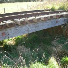
Hornby to Prebbleton rail trail
ViaStrada was engaged by Christchurch City Council to undertake the scheme design of the Hornby to Prebbleton section of the Christchurch to Little River Rail Trail. This followed on from our office undertaking the feasibility study for this same section.
Key Contact: Warren Lloyd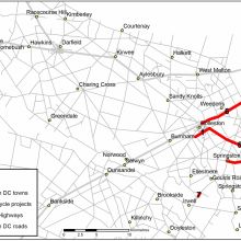
Selwyn cycling and walking paths
Jeanette, Megan and Andrew have recently undertaken feasibility assessments of seven walking and cycling infrastructure projects for Selwyn District Council. The projects included six shared off-road paths and opportunities to improve the Leeston Road bridge. We developed scheme plans for each of the projects and used these to estimate costs of construction and maintenance. We also predicted the demand for the facilities and calculated the value of expected benefits.
Key Contact: Axel Downard-Wilke
Further MOTSAM update
NZTA commissioned ViaStrada to update more MOTSAM (Manual of Traffic Signs and Markings) material. Gone are all the old double limit lines, for example. Some of the more noteworthy amendments are:
Key Contact: Axel Downard-Wilke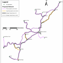
Canterbury Regional Cycling Network Development
The need for a regional cycle network had been identified in previous Environment Canterbury studies and strategies.
Key Contact: Megan Gregory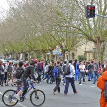
Auckland Learning Quarter cycling study
Auckland City Council (ACC) engaged ViaStrada to undertake a comprehensive cycling review for the "Learning Quarter", the campus area of the University of Auckland and the Auckland University of Technology (AUT), in the Auckland CBD.
Key Contact: Axel Downard-WilkeShared use path width investigations
ViaStrada has undertaken significant research and tool development on behalf of VicRoads (Victoria, Australia) to determine appropriate shared use path widths based on user volume characteristics.
Key Contact: Warren Lloyd